Showing posts with label rhododendron. Show all posts

Tuesday, March 16, 2010

High Ridge Run

In WV, the Allegheney Front is the boundary between the Blue Ridge Mountains and the Allegheney Plateau. It also helps to divide the Potomac drainage from that of the Ohio River (which the New, Gauley, Cheat, Youghioghney, and Tygart all join) in our State. The various branches of the Potomac have been boated for years, and are well know for their scenery; soaring Seneca Rocks, the wildlife and fishing of The Trough. Seneca Creek, a major tributary flowing off the highest point in the state, is one of the traditional Canaan area steep creeks, and was a proving ground in the infancy of vertical waterfalls and steep creeking. Exploration of other, smaller creeks has been minimal, with access, tiny streambeds, wood, and small flow windows deflecting a lot of effort. It is understandable, particularly when there is great class V boating ready to go on the other side of the escarpment. Interest and exploration has revived along the front however, and this past weekend I got to enjoy a great new creek.
High Ridge Run collects itself in a small drainage below one of the steepest parts of the Front. At the put in, the creek is tiny, and grows slowly as it drops 1000' in two miles toward the North Fork of the South Branch of the Potomac.
Harpers Ferry boater Mike Moore has been scouting this creek for years. I knew it as "Mike Moore's Secret Creek" long before I knew its name or location. He has scouted, checked on access, chatted with landowners and fisherman, and spent weekend after weekend clearing logs from drops and learning the creek. He must have a good Tom Sawyer speech too, because he drafted his friends to help him get things boatable. The hard work paid off, and I can't thank those guys enough for their effort.
Saturday morning found nearly twenty people hiking up a forest road to the top of the creek.

Sometimes the gate is open, but this was not one of those weekends. We climbed 1400' in two miles before turning left and crossing another mile down into the very top of the creek. I was soaked in sweat and hurting by the time it was done. I am terrible at pacing myself, and currently have sub-optimal fitness. (which begs the question of why I did it again the next day)

The hikers filtering down into the put-in, at the highest runnable portion of the creek.


Chuck Morris on the put in rapids.

The second significant drop: a transition onto a slab and then out.

Busy Busy Busy.
Whoah. Long day for this man, but he did it with a smile and a game effort. Big boat on a little creek.

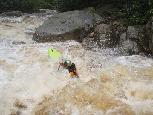
Sam Burke in one of the more boulder filled rapids on the upper section of creek. The rock to Sam's left dished out a lot of abuse, from scraped knuckles to full on swims. Above this drop is a 12' falls, and a 10' slide, and some other stuff all in sequence with no real stop. I ran it on verbal directions from Chuck, who got them from Mike Moore, who spent much of the day standing on various perches giving out directions like an air traffic controller. (or a mountaintop guru of rapid lines) Beta from Mike, and from Don Smith, who had also been on the creek previously, made for confident probing and bombing away.


Chuck Morris keeping his bow up in a tight LZ. Just below this ledge is a large, broken tree spanning the river. While you portage around the tree, you can take a moment to scout the confluence canyon.

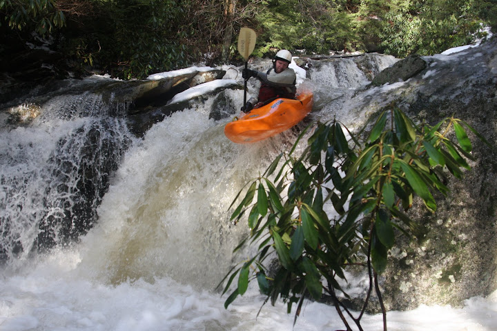
Don Smith runs the second of three drops in this sweet little crux gorge. 20' entrance falls, a 12' or so kicker in the middle, then a twisting slide to exit. At this point on the run, you have traveled about 1/2 a mile and dropped 400'. Awesome.

Geoff Calhoun finishes up the third slide.
A decent sized fork of the creek is entering on the river right, directly into the bottom slide. Beautiful place. The pace eases up somewhat from here down, and our large group of nearly twenty ended up stretched over several hundred yards of creek. Eventually, a handful of us, (chasing Jason Beakes) started moving really fast out in front and we split into two groups.

By really fast I mean we didn't scout here.

Or here. Or countless other ledges and turns. The work Mike and crew did, the super friendly nature of the creek, and some very comfortable probes out front made quick work of the bottom 1 1/2 miles of creek, which were still dropping at a 400-500fpm pace.

Mild mannered elementary school teacher Robert Miller genteelly makes his way down a babbling brook.

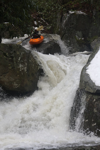
Don Smith loads up for the best boof on the creek. Taller than it looks.

Eric Amason charges around the corner and prepares to log dodge.
The creek quieted down even more below here, and was straightforward read and run to the takeout. These photos are by no means a complete representation of the creek, there is lots more I didn't have time or angles to photograph. Think of this blog post like a movie trailer, it tells enough of the story to get your attention, but by no means is it the whole thing.
High Ridge Run is an incredible combination of friendly streambed and gradient. Every drop is runnable, with countless 6-10' ledges and unique falls and rapids. It is a busy creek; there are no real pools anywhere along the run, and an out of control line can take a long time to recover from. Eddies were minimal at times, as can be expected for a micro-creek with this kind of gradient.
More pictures from our run can be seen on my picasaweb album. Hopefully I can add more pics and some video as the media other guys shot becomes available.
For Saturday's run, the NFSB Potomac crested near 11,000 cfs at the Cabins gauge. I don't think there is a direct correlation, but that gauge climbing high combined with heavy local rains is the best indicator that High Ridge Run is flowing. Seneca Creek was also bankfull in nearby Onego, WV on Saturday. A group of us went back in on Sunday, and while the creek was fun, it was really too low, the watershed is quite small for this creek, so catch it on the way up and don't delay, it won't hold it water for long.

Update: an addendum from Mike Moore himself. I'm just gonna quote his e-mail:
"Tim Gavin felt that the Allegany Front held secrets that us kayakers ought to know about, but we were all pre occupied with the Blackwater and North Fork @ the time, and could not be distracted with other things!
Jeff Cogle and I renewed the interest, flyovers on Google Earth and poring over the raised relief topo map Jeff has.
I was the 1st to step and see with boaters eyes, could not believe what I was seeing only a 1/2 mi up the creek bed, Chris Good and I went up to the confluence drop that same day, making it just @ dark. It looked like fantasy land, looking up @ the confluence drop in the fading light.
Back in the following weekend, and following 4 weekends, with Jeff Cogle, Clarke & Jeremy Gesey to begin working away and scouting the Upper section, which was dubbed The Wet Dream Section. Truly amazing section of whiteh2o, more boofs than any creek around, and hardly any boulders.
Exploring out of the High Ridge drainage has been fruitful as well, the whole Allegany Front is peppered with classic class 4-5 creeking in the wettest of times. Its nice to see a new place with world class runs when all of our west side creeks are blown out and our signature east side run[ Seneca] is too high.
So kudos to Timmy Gavin for the thought, and the inspiration to keep searching and discovering.
Somehow, I think Tim was along for that 1st D!"

Tuesday, May 19, 2009

A weeklong Celebration of the Cheat River drainage, Part Two (Hiking through the woods with a kayak, Waiting for the water to go away,and Red Run)

The Monday after Cheat Fest it began to really rain. Morgantown got 2+ inches of rain in the early morning hours. My wife had an exam, so I played some phone tag with people, and Ed Gaker and I agreed to meet up once Rebecca got home and settled in with the kids.
In the interim, Ben Dunham called and told me that everything he'd seen around Morgantown was blown out, and that he was on his way to Daugherty Run near Albright. I held out hope that Quarry might just be high, and maybe even falling, but an inspection at the top proved it had at least 2x as much water as was prudent, maybe more. Ed and I decided to leave a car at a nearby parking lot and go catch Ben. While we were parking, a truck drove by with boats. We waved at the guys, and they backed up to talk. They were planning to put on Clay Run, which drains the middle of Coopers Rock State Forest, and flows into Quarry Run in the steepest section. They'd hiked the run before and thought it would have some drops worth doing. I warned them that we'd seen waaaay to much water on Quarry, and wouldn't be able to boat below the confluence of the two creeks, but that we would probably be okay on Clay until then. Hopeful of something new to run, we set off on foot down the creek, essentially starting from the ridge atop it's headwaters.
3.5 Miles later, we reached Cheat Lake, having boated only a few yards of creek. The very top of Clay, out of the pond at the State Forest, was too small, and once there was boatable flow, the constant wood and lack of eddies in the tiny streambed made things difficult.
This 4' diameter culvert was interesting and fun early.

By the time we reached some good boulder piles and slides, the creek was high and still woody. Before long, we'd reached the confluence with Quarry Run, and 600+fpm does not handle the volume of water we saw in a "safe" or "fun" manner.

Big slide just below the confluence. This is the last third or so.

If you've ever seen "A Token of My Extreme" you may recognize this as the entrance to the real big slide where Jeff Snyder paddles into an overhung cave, disappears into the pillow and emerges onto the slide below. (Then vows "Not To Ever Do That Again") The cave is in the upper right quadrant of the photo, and was kinda full on this day.
Once we got back to the cars, the guys were kind enough to get me on the road home quickly, as I was late. They continued over to Bull Run after they ran the shuttle, and found it was much too high as well.
I spoke with Ben that evening, and he'd gotten three runs on Daugherty, including a solo sandwiched in between two different groups.

Tuesday morning brought still high flows and at least 4 different groups checked Bull Run throughout the day, expecting it to have dropped overnight, but it continued to remain much higher than anyone wanted. I stayed home with my kids while Rebecca studied for her next final. Creeks further out were running, but I hoped to stay on runs close to home and fast to do. Ed and I planned to try for Bull Run again in the morning,with him checking it early and hopefully getting a run in before his 11am final in Advanced Organic Chemistry. I also talked to Ben again, he did three runs on Fikes creek. A pattern is starting to emerge...

Wednesday I met Ed at the creek, and I think I pretty much talked him out of a high water run on The Matador, Bull Run's premier waterfall. A small storm cell had put 1/2" of rain right on the creek overnight, and it looked no lower than the day before. In retrospect, we should have put in below the falls and paddled the bottom of the creek at booming high water, but Ed was tired of driving to the creek and not being able to knock off the Matador, and just wanted to get going. Plus he had that final in a grad level chemistry class.
He did make up for it by running Stupid Falls on the East River in Colorado a week later, so hopefully he feels better now.

More rain was coming Wednesday night, so a bunch of people made plans to meet Thursday and try to get a run on one of the Canaan Valley creeks. 11am Thursday found lots of kayakers at the Otter Creek trailhead parking lot, the shared takeout for Red Run and Otter Creek. Seneca was too low, Otter was running, Red Run looked perfect, but might still be rising, and Red Creek had yet to be seen. We left cars at the trailhead, so we would have options, then drove to check Red Creek. It was too low, and the sun had come out, so we decided to get some burritos for lunch then put on Red Run.
Our group of 8 made quick work down to the first slide.
Ben Dunham, trying to keep warm in a pvc rain jacket (drytop forgotten at home).

Soon after is Goliath, a high speed, turning mix of bedrock and boulder
Don Smith starting at the top as Matt Fithian films.

Shawn Yingling up on the big pillow at the bottom, as Fithian continues to document.
Just downstream is the "Seed Spitter" drop, which I chose to walk, and then regretted after watching a couple boats go through. Not enough to un-portage and run it though.

Adam Johnson landing the pourover below the seed spitter slot.

Matt Fithian route finding in Maze rapid as Ben Dunham looks on. Ben is now warm in a borrowed drytop, thanks to the kindness of Jeremy, who abbreviated his own run to get to work on time.

Adam Johnson in the middle of the Maze.

Geoff Calhoun finishing up the Maze.

My favorite photo of the day, the bottom of Maze is just visible at the top of the photo.

Below Maze, we at a lot of time up getting around wood, pulling a log out of the water, and dealing with two equipment breaks. A snapped paddle blade, right above the Red Run Falls, and just below it, a badly broken boat, beyond any bituthane repair.

A breakdown solved Geoff's paddle problem, but Adam had to hike his boat out. Don volunteered to go with him, since he was familiar with the trails to the take-out, and also pointed out that daylight was fading, as it was about 6:30pm by then. The remainder of us continued downstream through several more big rapids, and then split up further at the cave rapid, which is hard to scout or film well, as it is ringed with large boulders and rhododendron. Three of us ran through, while the other two carried around and put back on a few minutes behind. With the exception of one poorly placed log, the mile below the Cave drop was fast, fun, read n run boulder gardens all the way to the Dry Fork of the Cheat.
A few more photos are available at my Picasaweb gallery, and at Shawn Yinglings.

Thursday, May 14, 2009

A weeklong celebration of the Cheat River drainage. AKA "How I spent my Cheat Fest" Part One.

Woohoo rain. I considered naming this blog something with "rain" in it, because its such an integral part of the boating here. Other than a few Dam release rivers, you can't go kayaking, especially creeking, without rain. I ended up doing something else, as there were several other folks writing under banners with "rain" in them, and I didn't want to seem unoriginal. So I stole a name from an old bumper sticker instead.

Cheat Fest is always the first weekend in May, and it's almost always wet, or at least damp. After a check of Bull Run, which my optimism convinced me was running, I got the kids to the sitter (Hooray! Grandma!) and met Adam Johnson. A second opinion and a few hours of ebb led us to leave Bull Run for another day, so we left a car at the adjacent Big Sandy/Cheat takeout, then backtracked to Deckers Creek. We had about 300cfs, which is a good minimum as the gage reads these days, and then drove up the mountain to the Little Sandy.
We were joined there by Jim, from New York/Connecticut, and headed down the tributary of the Big Sandy River. It was pretty low by that point in the afternoon, but once we reached the confluence of the Big Sandy, we were on big, brown, roiling water. And we were not alone! I have never seen that many people on the Big Sandy River. Dozens and dozens of boaters were enjoying the upper stretch of my home river. Eddys crowded with groups, craning over their shoulders to look downstream, with leaders explaining the wheres and whats. Surf spots were crowded, with friends corralling errant, driverless boats. It was pretty amusing and very colorful.
The river was still at 7.1 when Adam and I passed the bridge at Rockville, and after a quick help to some swimmers, we were downstream and all alone (Jim took out at the bridge, where his ride was waiting). The Lower Sandy was great, fast moving fun. One quick portage around the entrance to Big splat, and we were soon at Jenkinsburg, and then off to Cheat Fest.

Sunday brought drizzle and chillier temps, and after a round of calls and texting, I ended up back on the Big Sandy, with hopes for an afternoon run on something smaller. Ben Dunham, Bobby Miller and I got a quick run at 6.7, and Sean Devine met us back down at the take out. We popped over to check Bull Run, and decided to put on. It was low, but it sure beat folding laundry and watching TV, which is what I would've done at home.
Ben Dunham in the first rapid. If you have ever driven into the Cheat River take out (Jenkinsburg) from river left through Masontown, this is the drop next to the old mill (which is now a house).

Bobby Miller in the wall check rapid.

Video!:

Video by Bobby Miller. Thanks man. I stalled out a little at the lip, and ended up doing a weird twisting thing off the Matador. Ben did a nice job hustling into the eddy sans paddle yes? Bobby says it right in the video: Low but Fun. I'm glad I got on, especially since it eluded me the rest of the week.
I have a few more photos in a picasaweb gallery.

Monday, February 09, 2009

Elsey Run

The snow and ice have relented and we got warm (for February) temps, and on a weekend no less. Saturday night everything shot up, and Sunday offered lots of options. I enjoyed a lazy morning and caught up with a group who had just finished Daugherty Run, in Albright, WV. Five of us got together and headed up the mountain to paddle Elsey Run

Elsey is the steepest run in the Albright area, starting off with just a few minutes of warmup and then getting right into the goods.
Here is Art Barket getting back in the water after portaging around a log.
Note the heavy glaze of ice; we had difficult conditions for scouting and portaging drops. Slippery and cold.
From the first big scout, (which has a log in the entrance) Elsey falls out of the sky for a good half mile. There are 10 huge boulder drops, right on top of one another, with minimal eddies, logs in play, caves, rhododendron everywhere, and tough scouts and safety. You know, awesome. Sitting in bed last night, I realized I still smelled like Hemlock sap from all the scrambling amongst the trees. (*edit: looking at the map, this section falls at about 800fpm for a 1/4 mile)
JB Seay (me) enjoying the boof at the bottom of Acid Drop the first of the big ones. Photo by Art Barket.


Art in the middle of an easy one in the steeps.

For you guys who have run Elsey, the "room drop" is still diverting through the cave, with an uphill paddle to get to the old line. We skipped that one.

Sam Burk hitting up a nice slab of sandstone.


Ben Ledewitz styling the very next drop. JB Seay, Adam Johnson, and Sam Burk on safety. Art Barket behind the lens.


Me in the middle of my favorite drop on the creek. Photo by Art Barket.
This marks the bottom of the Captain Insano section.

Ben Ledewitz finishing er up. Photo by Art Barket.
Below here the creek transitions to high speed mank (description courtesy Ben Dunham) still short on eddies, and lots of logs and Rhododendron, but less stacked up. After a half mile of that, we reached the bedrock section of the creek, with half a dozen 10-25' slides all in a row.


Adam Johnson on a slide in his borrowed kinda old school creekboat. Whee.

As the canyon opens up, there is one last big one on the run, a 70 degree slide with some unfriendly guardian rocks on its right side. Sam and Ben aced that one, but with light fading we had no photo. In the classic video Fallin Down you can observe BJ Johnson and Colby Mackley running this drop with good result.
Below the Big Falls the creek is read and run all the way to the Cheat. It's a good thing, as at least one of the landowners along this section has threatened several times to shoot kayakers floating by for trespassing on his property. For this reason, we park at the Daugherty run take out just downstream on the Cheat and move fast when checking levels or finishing a run.
For more info you can check out my gallery, Art Barket's awesome set of pics and Sam Burk's post on the Team Riot site.


View Larger Map